Mineral Deposits and Exploration

Mineral deposits layers |
|
|---|---|
|
Mineral
Deposits- and Mines- layers are extracted from the GTK’s Mineral
Deposit database. Database contains all mineral deposits, occurrences
and prospects in Finland. Structure of the new database was created in
2012 and it is based on global geostandards (GeoSciML and
EarthResourceML) and classifications related to them. During 2013
separate mineral deposit databases (Au, Zn, Ni, PGE, U, Cu, Industrial
minerals, FODD) were combined into a single entity. At the same time
GTK’s mineral deposit viewing and download services were updated. New
database contains extensive amount of information about mineral
occurrence feature along with its associated commodities, exploration
activities, mineral resource and reserve estimates, mining activity,
production and geology. Database will be updated whenever new data
(e.g. resource estimate) is available or new deposit is found. Terminology of the mineral deposit database is based on EarthResourceML vocabularies (drafts and will be accepted end of 2013 – address coming later) – part of the lists is seen in INSPIRE Data Specification document – see pages 103 – 132. Information about New Mineral Deposits and Exploration web service and international geostandards – see Geofoorumi 2/2013 – Online geodata services become reality. |
|
| Mineral Deposits | |
| Mineral Deposits layers contain all the mineral
deposits and occurrences of Finland. Data is extracted from GTK’s
Mineral deposit database and it contains simplified information of the
deposits: name and alternative names, coordinates, commodities,
occurrence type, mine status, discovery year, total amounts of
commodities, latest resource/reserve estimate, current holder of the
deposit, metallogenic province and district, genetic type of the
deposits, host and wall rocks, shape of the deposit, orientation and
dimensions. Total amounts of commodities in the deposit are calculated from the latest resource/reserve estimate and total production (if mined). Size of the deposit is defined by the total amount of each commodity. Size categories are based on the INSPIRE Data Specification document - see pages 164-168. If there is no information about total amount of commodity, size category is NA. A deposit can contain many commodities, thus one deposit can occur in several layers. However, there is only one primary commodity per deposit. These are shown in the All Deposits –layer. Deposits are also classified into separate map layers by the end use potential of the main commodities. These layers contain all the main commodities which occur in the deposit. Symbol style and size are defined by the commodity and size of the deposit. Styles and size for the mineral deposits are based on the INSPIRE Data Specification document- see pages 71-77. 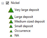 |
|
| Mines |
|
|
Mines-layer shows all the mineral deposits with mining
activity. Mines -layer is extracted from the GTK’s Mineral deposit
database and it contains following information: mine name and
alternative names, coordinates, mine status, current holder of the
mine, start and end year of mining, total years mined, main product,
size of the deposit, total production, total ore and waste rock mined,
all commodities of the deposit and latest resource/reserve estimate. |
|
| Exploration layers | |
| Bedrock observations |
|
|
Bedrock observations -layer contains location data for over 650 000 outcrops. Observation data has been produced by Geological Survey of Finland and Outokumpu Oy bedrock mapping and exploration activities since the beginning of 2000 century. |
|
| Bedrock drillings | |
|
Bedrock drillings -layer contains location data for over 26
000 drill holes. Drilling data has been produced by Geological Survey
of Finland and Outokumpu Oy bedrock exploration activities since 1920. |
|
| Ore boulders and showings |
|
|
Layman samples Layman samples contains mainly boulder but also bedrock observation data for over 24 000 layman samples send to Geological Survey of Finland and Outokumpu Oy. Data set contains also analysis data in case the samples have been analysed. Boulder observations Boulder observations -layer contains boulder observations
gathered by Geological Survey of Finland and Outokumpu Oy. It also
contains boulder ore showings gathered by GTK. The total amount of
boulders is approximately 23 000. More
information on rock types used in the data set (in Finnish). |
|
| Geological maps |
|
|
Bedrock of Finland 200k Bedrock of Finland 1:200 000 is a unified whole of Finland database, which has been compiled by generalizing the not-to-scale data. The data consists of a lithological unit layers (Rock class and Rock name) and structural line layer. Lithological unit layers (Rock class/Rock name) include unit codes, age information and lithological codes as attributes in accordance with the Finnish Register of Geological Bedrock Units (Finstrati). The structure layer includes structure types. Superficial deposits of Finland 200k Superficial deposits of Finland 1:200 000 is a unified whole of Finland database, which has been compiled by generalizing 1:20 000, 1:50 000 and 1:100 000 Quaternary base maps. Surface sediment –layer shows the blanketing peat overburden and Base sediment –layer contains soil types. Bedrock map of Finland 1M The Bedrock map of Finland 1: 1 000 000 shows the basement
lithologies by age group, as tectonic units and divided into the
following domains: the Lapland Granulite Belt and Inari Complex,
Karelian Domain, the Svecofennian Domain and the Caledonian Domain. Map
data includes lithology and granulite regions as areas; dykes, tectonic
structures, lithological trends, kimberlite provinces and domain
boundaries as lines, and meteorite impacts as points. Superficial deposits of Finland 1M Superficial deposits of Finland 1:1000 000 present the
sediments which are classified according to their mode of geological
development. The deposit classes are pre-Quaternary bedrock exposures,
various Quaternary deposits and landforms. |
|
| Metallogenic areas in Finland 2M |
|
|
The metallogenic map shows the extent of presently known metallogenic areas in the Finland, defined by the presence of metal mines, deposits, favourable bedrock geology, and by indications from geophysical and geochemical surveys. More information: Mineral deposits
and metallogeny of Fennoscandia, GTK 2012. |
|
| Radiometric ages |
|
|
Radiometric ages contain published isotope results from
Finland, which comprise predominantly U-Pb zircon data produced at the
Geological Survey of Finland. The information given in the "Published
age determinations" section consists of location data, rock type,
minerals analysed, method, age data, references and comments. The
"Published Sm-Nd isotope results" gives data in standard format,
predominantly produced at GTK. More information: Isotope
Results of Finnish Bedrock |
|
| Geochemistry |
|
|
Regional till geochemistry Regional till geochemistry describes the distribution of 25 elements in basal till. The sampled material was chemically unchanged C-horizon till preferably under the water table. The average sampling depth was approximately 1.5-2 m. Sampling was done during years 1983-1991. The sampling density was one sample per 4 km2. The whole country was covered by the till sampling and the total amount of samples is 82062. The samples were collected as composite of 3-5 subsamples. The coordinates of each sample are calculated based on coordinates of these 3-5 subsamples. More information: Geochemical Data, Regional Geochemical Mapping in Finland in 1982-1994. Targeting till geochemistry Targeting till geochemistry contains information on soil sampling and geochemical analyses. Sampling was done by GTK during 1971-1983 and it contains approximately 385 000 samples. Sampling was done discretionarily by 1:100 000 map sheets in lines. Sample material is mainly glacial till, but also weathered bedrock, graded sediments and their mixed variants are included. More information: Report on geochemical mapping methods. Rock geochemical data The Rock Geochemical Data contains the total and partial concentrations of 57 elements in the bedrock of Finland analysed using several different methods. The data cover the whole Finland and consist of 6544 samples taken by a mini-drill with the sampling density between one sample per 30 km2 and one sample per 120 km2. In addition to the chemical concentrations, the data include information on the quality of the chemical analyses, geographic location and several geological attributes for each sample. More information: The Rock Geochemical Database of Finland Detailed till geochemistry GTK detailed till geochemistry contains location and
information of soil sampling done by Geological Survey of Finland.
Sampling has started in 1970 and it still continues. Regional stream sediment geochemistry Regional stream sediment geochemistry contains information of
organic and mineral samples and the geochemical analyses. Sampling was
done by GTK during 1971-1985 and it contains approximately 156 000
samples. Analysed samples are in separate layers classified by sample
type (organic/mineral) and analysis method. More information (in
Finnish): Report
on geochemical mapping methods |
|
| Mining Registry |
|
|
Mining Act 1.7.2011 Mining registry according to the new mining act (621/2011) after 1-Jul-2011. More information: https://tukes.fi/en/mining © Finnish Safety and Chemicals Agency (Tukes) Previous Mining Act Mining registry according to the previous mining act (503/1965) before 1-Jul-2011 Expired claims Expired claims contain historical information about expired
mineral exploration claims and permits granted upon the Finnish mining
law. The dataset contains an expired claim or exploration permit area
as polygon, the attributes related to this specific area and the
hyperlink to the mineral exploration report, if such a report has been
relinquished. The dataset contains material since 1948 forward. |
|
| Nature conservations areas |
|
| Groundwater areas |
|
|
The dataset includes those groundwater areas that are investigated and classified for the water supply purposes. Groundwater areas are classified based on their usability and protection requirements to three classes: Class I = Groundwater area important for water supply, Class II = Groundwater area suitable for water supply, Class III = Other groundwater area. More information: Metadata. © SYKE, ELY-Centres |
|
| Natura 2000 |
|
| The dataset contains nature conservation areas belonging to the Natura 2000 network. More information: Metadata. © SYKE. | |
| Nature conservation areas |
|
| The dataset contains nationally designated protected areas established on state owned land in accordance with the Nature Conservation Act or Nature Conservation decree, and areas established on private lands with a decision from the local Centres for Economic Development, Transport and the Environment (ELY-Centres). The dataset includes also extensive wilderness areas which are maintained in natural state and are at least partially naturally managed. The data on reserves on State-owned lands is produced by Metsähallitus. Protected sites established on private lands are digitized in ELY-Centres (by the responsibility area for Environment and natural resources). More information: Metadata © SYKE | |
| Geophysical maps |
|
| Ground geophysical surveys |
|
| A ground geophysical survey
contains surveyed areas as polygons and metadata relating to the
survey. Geophysical surveys are done by Geological Survey of Finland
and Outokumpu Oy. |
|
| Detailed aeromagnetic surveys |
|
| The GTK has carried out detailed
aerogeophysical low-altitude surveys during 2001-2008. The flight
altitude has been 30-40 m and the flight line spacing 50 - 100 m.
Sample distance along the survey line has been 6-50 m depending on
registration rate. The flight direction was selected perpendicular to
the main geological structures. |
|
| Bouguer anomaly map of Finland
2.5 km x 2.5 km |
|
| The Bouguer anomaly map of
Finland contains the Finnish section of the Bouguer anomaly map of the
Fennoscandian Shield, 1: 2 000 000 (resolution 2.5 km x 2.5 km). The
origin of Finnish section of the map is the regional gravity data of
the Finnish Geodetic Institute and the Geological Survey of Finland. |
|
| Aerogeophysical low altitude
surveys |
|
| Low altitude aerogeophysical maps covering whole Finland. Aerogeophysical surveys were carried out during 1973-2007. The nominal flight altitude was 40 meters and flight line spacing 200 meters. Sample distance along the survey line has been 6-50 m depending on registration rate. The choice of standard flight direction (North-South and East-West) was made to suit the main geological trends. More information: Aerogeophysics in Finland 1972–2 004 Methods, System Characteristics and Applications. | |